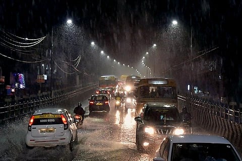
Tamil Nadu is bracing itself for cyclonic storm Gaja, which is currently centred about 720 km east-northeast of Chennai. The Indian Meteorological Department (IMD) has predicted that the cyclone will move closer and likely intensify into a severe storm within the next 24 hours. Rains will however hit Tamil Nadu only from Wednesday night.
A red alert has already been issued to coastal districts in the state. According to the IMD, the state will witness rainfall between November 14 and 16. Heavy to very heavy rains can be expected in Thanjavur, Tiruvarur, Karaikaal, Cuddalore and Villupuram. In addition to this, sea levels will rise in Nagapattinam, Thanjavur, Pudukkotai, Ramanathapuram and Kaaraikal districts by one metre. The wind speeds in this region can vary between 80-100 km/hour. The seas have been deemed too rough for any fishing activities till November 15.
As far as Chennai is concerned, Srikanth, co-founder of weather blogging site Chennai Rains, predicts that the city will see moderate spells of rain within this period.
“The cyclone in all probability is likely to go south of Tamil Nadu. As of now, landfall seems likely in Nagapattinam,” he points out. “Chennai is in a worrying situation because of the lack of rainfall so far. Some relief can be expected this week from November 14 and there may be temporary waterlogging. The cyclone may also weaken before depression, which means that wind speeds will only be up to 50 km/hr,” he adds.
The blogger further predicts rainfall in areas such as Papanasam, parts of Kanyakumari and parts of Virudhunagar, after the landfall.
Weather enthusiast and ‘Tamil Nadu weatherman’ Pradeep John has also predicted good rains for the city.
“Chennai is expected to get rains a day early from November 14. Entire North Tamil Nadu coast will get rains from 14th or 15th. Though Chennai might be windy, we will be very far away from the influence of Cyclone winds. But the good news is Chennai will get pull effect rains on 15th and 16th too. So the rainfall expected is more now compared to previous days forecast. I will be happy with 150 mm rainfall from 2-3 days from Gaja in Chennai. Remember we have just got 200 mm from October 1st in Chennai (sic),” his post on Facebook reads.
As for the rest of Tamil Nadu, he concurs that extreme rainfall is expected in the landfall area of the delta belt and southern interior districts. But the intensity, he predicts, will not be as damaging as previous cyclones seen in the region.
“Gaja will have much lesser intensity than Cyclone Vardah in Chennai, which clocked 120 km/hr winds with gusts of 140km/hr. Cyclone Thane in Cuddalore had clocked 140 km/hr and gusts reached 160 km/hr,” the weatherman points out.
The IMD further pointed out that there was no reason for residents to worry and that the red alert was to ensure that district authorities were prepared for the incoming rains. The Chief Minister also called for a top-level meeting to ensure that precautionary measures were in place to handle the storm.
