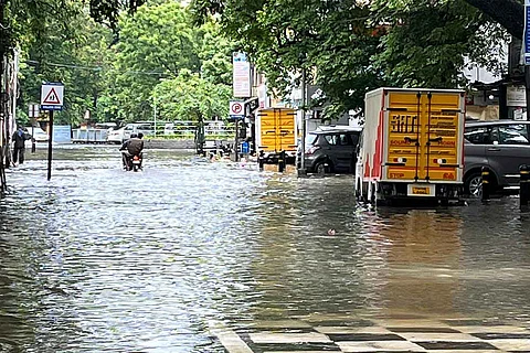

Chennai received rains in excess of 20 cm on the night of November 6, the heaviest spell since the 2015 floods. However, a broken, outdated and ill-maintained weather prediction system used by the Regional Meteorological Centre failed to predict that the city would witness such heavy rainfall in a short span of 24 hours. An official from the Regional Meteorological Centre, Chennai, confirmed that two weather radars — one in Chennai and another in Karaikal — had been under maintenance on November 6, totally failing to predict the record rainfall on November 7. But this is just one part of the problem.
While old and failed radars are an issue, there are other specific problems too, including different predictions by the same department and the overdependence on single systems. To understand Chennai’s problems, it is important to know the two kinds of weather predictions — nowcasting and forecasting.
Nowcasting is a technique used to forecast weather conditions in the short range, i.e. within a period of zero to six hours. Nowcasting is done by taking estimates of the wind speed and direction of wind movement to forecast weather in the short range. Forecasting, on the other hand, predicts weather changes for longer time periods.
While doppler weather radar systems are useful for nowcasting, satellite images help in both nowcasting and forecasting for longer periods of time, especially while tracking events like cyclones etc.
On November 6, Saturday, Chief Minister MK Stalin called for a preparatory meeting as IMD had forecasted heavy rains after the onset of the North East monsoon. An alert on November 6 afternoon predicted heavy to very heavy rainfall in north coastal Tamil Nadu. North coastal Tamil Nadu includes around 14 districts, and there were no other specifics in this bulletin.
Image: IMD Bulletin on November 6th afternoon.
But in the same bulletin, IMD gave an orange alert — which is a direction to be prepared for floods — for the entire state. Ideally, the IMD should have given a red alert which is to ask the state to take action.
However, it’s the Regional Met Centre's job to specify which areas in the state will be affected — and while the daily bulletin from the Regional Meteorological Centre at 1 pm on November 6 spoke about a cyclonic formation, and predicted rainfall in many areas, it did not predict heavy rainfalls for Chennai on November 6. The regional office predicted heavy rains only for Cuddalore, Mayiladuthurai, Nagapattinam, Tiruvarur, Thanjavur and Pudukottai districts of Tamil Nadu and Karaikal area in Puducherry on November 6.
For November 7, the same bulletin predicted moderate rainfall for the city, with some heavy spells in some areas.
This is not the first time that one or more weather radars around the city have stopped working ahead of a major spate of rains. In November 2020, in the week preceding cyclone Nivar, the Regional Met Centre website showed that the Karaikal doppler weather radar was under maintenance. So in November 2020, the Meteorological Centre had to rely on the Sriharikota radar.
In November 2021, it also had readings from an X-band Doppler Weather Radar situated inside the National Institute of Ocean Technology (NIOT) in Chennai. This X-band radar, however, is less powerful than the main radar located inside the Chennai Port Trust, with a maximum range of 150 to 200 km.
By November 6 afternoon, the Chennai Corporation was aware that there was a possibility of heavy rains, thanks to weather bloggers. Chennai Corporation Commissioner Gagandeep Singh Bedi told TNM, “The day before the floods, the CM held a meeting. And I conducted a meeting with all the officers. I have previous experience in disaster management. We are not just dependent on the Met Centre or just one system but also on weather bloggers. The bloggers had already told me that we would receive around 150 to 200 mm of rain so I had put every measure in place. All the required people were there in the control room. I was on the road since 4 am on Sunday morning. So the Chennai Corporation did not miss anything. We have documented this in our meeting the previous day.”
So how could weather bloggers understand that a heavy event was likely to happen? This is because many of them keep track of multiple international models.
India uses four kinds of Global Forecast Systems or GFS — the India Meteorological Department GFS model; the numerical weather prediction system developed by the centre of NCMRWF (National Centre for Medium Range Weather Forecasting) under the Ministry of Earth Sciences; the short range deterministic forecast system with GFS developed by IIT Madras; and the Weather Research and Forecasting Model (WRF), a numerical weather prediction system for atmospheric research and forecasting. However, none of the four weather prediction systems could forecast the heavy rainfall event from November 6 night.
A weather service system run by the United States, however, picked up the cloud build up and predicted a heavy event, rainfall between 90-200 mm in the Andhra-Tamil Nadu region. The weather system is developed by the National Oceanic and Atmospheric Administration (NOAA), which falls under the US Department of Commerce. In fact, officials in the state were in touch with bloggers based out of the Delta region too.
Image: The forecast by NOAA for November 6.
“We can't literally translate exact numbers from models, as in how many centi metres of rain will fall. These models can predict heavy rain events and the NOAA model did that,” a weather blogger told TNM.
“The issue is that radar systems are ideal for nowcasting. On November 6, the Karaikal radar — which is an S-band radar — was down because of maintenance issues. The X-band radar in Chennai was only calibrated on Monday, November 8. So we (bloggers) had no option but to rely on foreign systems or satellite images,” weather blogger K Srikant told TNM.
Three weather bloggers TNM spoke to including Srikant pointed out that dependence on one system was India’s biggest problem. “Just the GFS system is not enough, we need different prediction models and calibration. Or these kinds of events will recur,” one of the bloggers told TNM.
“The issue is that satellite imagery tends to underestimate or overestimate rainfall intensity. For Saturday, the satellite images did show deep convective clouding over the region. But many bloggers, including myself, failed to predict the scale or intensity of rains that the region would receive. We expected heavy rains, but on Sunday (November 7) morning the most rainfall was received in a span of 45 minutes in two spells. Such was the intensity,” Srikant explained.
Speaking to reporters in Chennai on Sunday, November 7, S Balachandran, Deputy Director-General of Meteorology, Regional Meteorological Centre, said that though they had forecast heavy rains for Kanchipuram, Thiruvallur and Chengalpet, they had failed to forecast heavy rains for the city the previous day. Chennai received heavy rains in a short window, he said, pointing out that until 10 pm on Saturday, November 6, the city had received only 3 cm of rainfall. However, from 1 am to 1:45 am on November 7, Chennai received 6 cm of rainfall, and then 7 cm of rainfall between 5 am and 6 am. “This is called mesoscale phenomenon (where rain falls) in a short time. It is very difficult (to predict),” said Balachandran. He added that Nungambakkam had received 21 cm of rainfall while Meenambakkam, which is 20 km away, received 11 cm, making such localised forecasting challenging.
With inputs from Pooja Prasanna