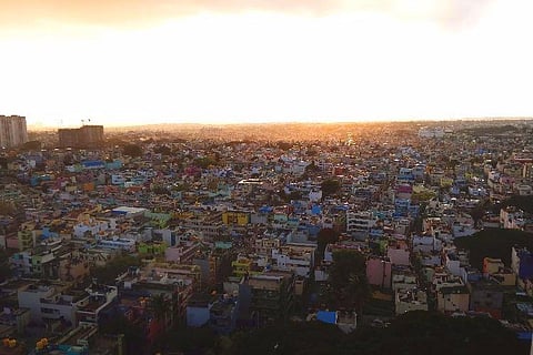
The Urban Development Department in Karnataka released the draft plan of delimitation of wards under the Bruhat Bengaluru Mahanagara Palike (BBMP) on March 3. This was released amidst much controversy and opposition from the Congress.
In this process of redrawing borders of wards, the BBMP has dropped 29 wards to make way for an equal number of new wards to be carved out of existing big wards. These 29 wards, which are recommended to be dissolved, are mostly wards held by Congress corporators, including Jayanagar and Rajarajeshwari Nagar (both held by former Mayors).
The delimitation process involves redrawing the borders of the existing wards as part of an Assembly constituency, to ensure all wards have relatively the same population (around 45,000 per ward), as per the Karnataka Municipal Corporation Act. This delimitation is being done as per 2011 Census data and a similar exercise was carried out in 2010.
You can access the interactive map here. (http://bbmpwards2019.com/)
No scientific assessment: Congress
The Congress has alleged that in the garb of a routine reorganisation, the ruling BJP has used its power to settle political scores with an eye on the impending BBMP elections, scheduled to be held later in the year.
“There is no scientific assessment in the current draft. In many areas, especially in Hebbal and Mahadevpura, they have added more areas to already big wards,” said Sampath Raj, Congress corporator and a former mayor.
“We have already sent our objections. I have met the Deputy Commissioner, who has assured to look into the matter,” he added.
The other wards, which will be removed, per the draft plan, include Atturu, Byatarayanapura, Kuvempu Nagra, Gangenahalli, JC Nagar, HMT, SK Gardan, Jayamahal, Shivaji Nagar, Kadu Malleshwara, Mahalakshmipura, Prakash Nagar, Kamakshipalya, Agrahara Dasarahalli, Marenhalli, Mudapalya, Agaram, Sudhama Nagara, KR Market, Rayapuram, Adugodi, Ganesha Mandira, Pattabhirama Nagar, JP Nagar, Subash Nagar, Cottonpet and Konanakunte.
The new wards that will be carved out are Bettahalli, Kogilu, Gundanjaneya, Amruthahalli, Ramachandrapura, RT Nagar, Bahubali Nagar, Kengunta, Mallathahalli, Maruthi Nagar, Amarajyothi Nagar, Kalyana Nagar, Dharmagiri Sri Manjunatha Swamy Temple, Sheshadripuram,
A general trend that has been observed is that the wards in old Bengaluru areas, especially Central Bengaluru have been merged. and there are new wards peripheral areas that have seen spurts in population growth. As a result, assembly constituencies like KR Puram, Mahadevpura, Byataranapura, Yeshwantpura, RR Nagar and Dasarahalli, Sarvajna Nagar that has seen exponential growth in population will have more wards.
‘Need a structured plan’
Apart from the Congress, many citizens’ collectives too have opposed the draft plan.
Taking the example of Mahadevapura zone, Whitefield Rising (a citizens’ group), said that, in order to achieve the target population of 42,000 per ward, the BBMP zone will require 17 wards, considering the number of voter registrations in the constituency and considering that only 70% of the population in the zone are voters.
The total population in the zone is assumed to be 7.5 lakh. Going by the draft plan, which proposes 10 wards for the Mahadevapura, each ward will have a population of 75,000, the collective pointed out.
Besides, it is not possible to add more wards as the number of wards in a civic body cannot exceed 200, according to KMC Act. Currently, the BBMP has 198 wards.
The Whitefield Rising has therefore demanded a separate civic body for Mahadevapura, citing the BS Patil Committee recommendations, which suggested that Bengaluru can be divided into five smaller civic bodies and 400 wards in total.
Speaking to TNM, Sandeep Anirundhan of Citizens Agenda for Bengaluru, said, “Why can’t the old village boundaries be converted to ward boundaries, or at best, a cluster of villages. Boundaries are haphazard, as it cuts old villages into different parts, which, in turn, creates further problems.”
According to Sandeep, the draft plan by the state government’s Urban Development Department is illegal as it is in contravention of the 74th Constitutional Amendment, which is based on the principle of self-governance, without any intervention from the Chief Minister or Legislative Assembly members.
He also suggested that the authorities provide a system of superimposed digital maps of new draft ward boundaries to make it easier to understand the geography of each ward.
Bengaluru NavaNirmana Party (BNP), a new political outfit focused exclusively on Bengaluru, too, called for a more structured, area-wise division.
Sowmya Raghavan, another BNP leader, pointed out that there is no clarity as to how the population and voters of each ward have been determined. “If the estimate of the population has been done based on the 2011 Census, then the parameter applied to account for the increase (in population) since 2011, needs explanation. For example, wards on the outskirts have recorded more growth than those in the interiors. It is also unclear whether the estimate of the population is based on the number of property-tax payers or water or power connections.”
According to Srikanth Narasimhan, General Secretary, BNP, the total area of Bengaluru within BBMP limits is about 710 sq. km, the total road length is roughly 13,483 km and the population around 1.25 crore. “It is advisable to set boundary conditions for each ward, for example, the area should not exceed 6 square kilometres with a road length of around 100 km and a population of not more than 75,000 people. This should be the basis on which the wards should be mapped and redrawn,” he suggests.
Adding to this, Lalithamba BV, Executive Committee Member, BNP, stated if their formuale is followed only 32 wards will not conform to the ideal boundary conditions. " The solution is simple, as these wards can be split and reconstituted as 64 wards while the remaining 166 wards can be compressed to 125 wards. This will ensure that all the wards fulfil the boundary conditions and become far more easily manageable,” she said.
At present, residents can suggest changes to the draft along with detailed reasons for the same via email (dcurban@nic.in) or letters to the Deputy Commissioner’s office till March 16.