Subscribe
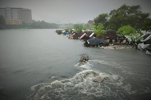
India is a country with a rich tradition of rituals. Even post-mortem discussions about lessons learnt from a disaster are reduced to a mere ritual. Every December since 2004, I write articles about the tsunami and the lessons taught by that giant wave. Then there is the Bhopal disaster season of December, the Fukushima nuclear disaster season in March. But with natural disasters becoming so commonplace, we don't but could observe several other seasons.
These include heat wave season between May-June, Odisha cyclone season after July, the southwest monsoon-flooding season between July and September. We could also observe the northeast monsoon-flooding season between November and December, and the Andhra, Nagapattinam or Cuddalore cyclone season between October and December.
In January, when dry weather returns, the floods will be a distant memory. When rains render people homeless, kind-hearted people jump to aid them, house them and care for them. When the Corporation of Chennai renders them homeless by evicting them to beautify the Cooum, we either sit by and watch, or worse, laud the efforts as a necessary move to clear waterways and water bodies.
We can be sure that, once the water recedes and the resolute survivors of this tragedy begin to rebuild their lives, the Government of Tamil Nadu will use the floods as a justification for the forcible but selective eviction of encroachments. Encroachments by the poor will be targeted, and elite encroachments tolerated and even encouraged.
The word "Encroachment" is often only seen in its legal sense -- on whether the structure has legal sanction or not. Nature does not look at encroachments in this minimalist manner. A perfectly legal building with all the necessary papers can still be an encroachment if it is located in an environmentally sensitive area. The MRTS train line, running through the Buckingham Canal is an encroachment. The Madurai High Court premises located inside a water body is an encroachment. Below is a selection of encroachments in water bodies, or on watercourses. Many of the below places were badly affected during this years floods.
1. Indian Maritime University, Uthandi:

(The area in 2002)
Indian Maritime University is an engineering university that is coming up in a flat sandy area, which is part of a floodplain on the western side of the Buckingham Canal and Kovalam Creek at Uthandi. The area is entirely paved. Where sand has a great capacity to absorb rainwater and reduce run-off, paved surfaces will exacerbate flooding through increased run-off. The college is not yet fully open. But when it does open, and when the next unprecedented rains visit us in the not too distant future, students can thank the management, not Ramanan, for the rain holidays.
(The area in 2015)
2. Chembarambakkam:
(The area in 2002)
This lake has been unfairly blamed for causing people harm this monsoon. Indeed, automakers and IT companies have found fault with "namma chennai" and complained that the flooding shows the city in poor light. This is ironical, since it is these companies and the infrastructure that they have demanded that has hurt so many Chennaiites.
In Chembarambakkam, as in Oragadam, auto manufacturers and their suppliers have populated hydrologically sensitive catchment areas with their factories. The road to a watery hell, they say, is paved. Hyundai Motors operates a factory near Chembarambakkam lake.
(The area in 2015)
3. Oragadam:
(The area in 2006)
Renault Nissan, Daimler Benz and Ford operate auto factories on lands that were once water bodies, paddy lands and forests. All automakers have suspended production at their plants until further notice.
(The area in 2014)
4. Kovalam Creek:
(The area in 2002)
Resort tourism and high-end farmhouses have come up along the creek compromising the ability of the creek to mitigate flooding.
(The area in 2015)
5. Okkiyam Thuraipakkam:
(The area in 2002)
The Okkiyam Maduvu is a narrow chicken's neck watercourse that facilitates tidal exchange in the mighty Pallikaranai marshland. Wise planners would have left a healthy buffer around the Maduvu. But Chennai has permitted IT companies, apartment complexes for IT employees, and the Kannagi Nagar colony to come up close to where floodwaters converge to pour into the Maduvu. These areas were badly affected.
(The area in 2015)
6. Siruseri:
(The area in 2002)
The area where IT industries have come up in SIPCOT, Siruseri, was and still is the converging point for floodwaters from two drainage systems entering the Kovalam creek. SIPCOT is under water and inaccessible.
(The area in 2015)
7. Velachery:
(The area in 2000)
If you look at the Velachery area before the MRTS and the explosion of construction that rode the coat-tails of the IT boom, it is no wonder that Velachery was badly hit in this year's rains.
(The area in 2015)
8. Sholinganallur
(The area in 2002)
Sholinganallur has seen local land-use change drastically in the areas between the Old Mahabalipuram Road (OMR) and the Buckingham Canal. The OMR itself has become a multi-lane raised road that cuts across the drainage path of waters headed to the Buckingham canal.
(The area in 2015)