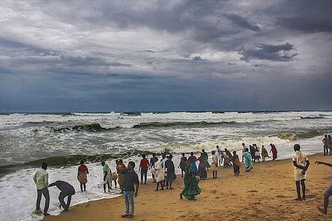

Over the last few months, scientists have been observing unusual activity in the Arabian Sea. The oceanic basin to the west of the Indian sub-continent which usually sees low-intensity cyclonic activity has suddenly turned into a hotspot of sorts, churning out severe cyclonic storms one after the other.
2019 recorded one of the most active cyclone seasons in the North Indian Ocean. Four cyclones formed off the coast of India in the Arabian Sea – Vayu, Hikaa, Kyarr and Maha. While Vayu, Hikaa and Kyarr did not make landfall in India, the western coast from Kerala to Gujarat witnessed heavy rains and strong winds, affecting normal life in several areas.
Officials of the India Meteorological Department (IMD) as well as climate experts are expecting more tropical cyclonic activity from the North Indian Ocean until December. But it is crucial to understand the growing cyclone activity in the region.
TNM spoke to two experts who believe that among other factors, the ongoing climate emergency, could be the reason for this abnormal activity in the Arabian Sea.
Reasons for multiple cyclones in the Arabian Sea
To understand the frequent and severe tropical cyclones in the Arabian Sea today, one must go back 60-70 years in time and study the climate changes then, says Venu G Nair, a meteorologist at the Centre for Earth Research and Environment Management.
A huge change occurred in the year 1976, when scientists across the world confirmed a sharp rise in temperature in the Pacific Ocean's equatorial region. The Sea Surface Temperature or SST of the Pacific Ocean rose suddenly and affected the atmospheric dynamics and wind patterns across the planet, says Venu. The year was identified as a 'climatic shift' by experts.
"East Asian countries, particularly China, and its carbon emissions is said to have contributed to the heating up of the Western Pacific Ocean, since oceans absorb nearly 40% of the CO2 emitted by human activity," says Venu.
So how did this affect the Indian sub-continent?
The excess heat energy in the Western Pacific Ocean was transferred to the South Indian Ocean via the Indonesian Throughflow (ITF), a low altitude, oceanic pathway for warm, fresh water to move between the two ocean basins.
The ITF is the only open pathway between the Western Pacific and the south eastern tropical Indian Ocean and flows through the Indonesian Archipelago.
This oceanic pathway has immense influence over the region's climate patterns. According to one study, done on ITF state, "The volume, heat and freshwater carried by the ITF are known to impact the state of the Pacific and Indian Oceans and modulate regional climate variability through altering the regional air-sea exchange and precipitation patterns."
Venu states that is is this transfer of excess heat energy via the ITF, among other factors, that has led to a noticeable increase in the Indian Ocean's sea surface temperatue or SST over the decades. "Studies measuring the SST rise in the Indian Ocean shows that the water has warmed up to a depth of 2000 mts or 2 kms, from 200 mts recorded earlier," he says.
Satellite image of extremely sever cyclone Maha by the IMD
From the Southern Indian Ocean, the warm water moves further to the Northern Indian Ocean via the western boundary currents or Monsoon drifts found near the Arabian Sea, explains Venu. This explains not just the frequent and sudden cyclonic storms in the Arabian Sea, but also the changed behaviour of the monsoons.
Fahadh Marzook, a hazard analyst and climate expert at the Kerala State Disaster Management Authority (KSDMA) also confirms that increase in sea surface temperature has triggered more cyclones in the Arabian Sea.
NASA satellite image of very severe cyclonic storm Vayu over the Arabian Sea
"The first condition for a cyclone to form is rise in temperature. The hot air goes up and a low pressure forms. Anything above 27 degree centigrade is ideal for the formation of depressions which turn into cyclonic systems above the ocean. This is why we are seeing increased cyclonic activity in the Arabian Sea as the SST has risen over the years," he says.
The rise in SST also explains how the monsoon behaviour in the country has noticeably changed, with extreme rainfall resulting in landslides and flooding in several places. Simply put, the excess heat has led to excess evaporation and water vapour in the atmosphere, leading to extreme rainfall patterns, Venu explains.
Warming of Arabian Sea, cooling of Bay of Bengal
Not only is there growing formation of cyclones in the Arabian Sea, these storms have also been increasingly severe in intensity. The year 2019 has already seen four cyclones ranging from 'very severe cyclonic storm to super cyclone' developing in the Arabian Sea - a rather unusual phenomenon in the region which could be linked to global warming.
It began with Cyclone Vayu in June which was classified as a 'very severe cyclonic storm' by the IMD with wind speeds of 150 kmph. This was followed by Cyclone Hikaa in September, which again termed a 'very severe cyclonic storm' and moved in north-west to make landfall in Oman.
NASA satellite image of Super Cyclone Kyarr in the indian Ocean
The most recent Cyclone Kyarr, was the first super cyclone with windspeed of 250 kmph to form in the Arabian Sea after a gap of 12 years. Kyarr, which is a category 4 hurricane was only preceded by Super Cyclone Gonu in 2007, which ravaged the coast of Oman. However, it's not the formation of a super cyclone in the Arabian Sea that has triggered interest, but the simultaneous development of two big cyclones in the region. Extremely severe cyclonic storm Maha, developed over the Arabian Sea, even as Kyarr prevailed and is expected to make landfall in Gujarat on Thursday.
"This is for sure a rare occurrence. Two big cyclonic systems forming at the same time could also influence each other's wind systems and lead to pushing and pulling. This is usually known as the Fujiwhara effect - named after the Japanese Meteorologist Sakuhei Fujiwhara - when two nearby cyclone vortices orbit each other," Fahad adds.
Interestingly, while the Arabian Sea warms up, the northern part of Bay of Bengal is witnessing a cooling phenomenon due to fresh water discharge from the melting Himalayan glaciers and other factors, according to Venu.
"The two seas are going through different climatic phases. The Bay of Bengal is usually susceptible to pre and post monsoon cyclonic storms. But if you notice, no cyclones have been created in the Bay of Bengal, barring Bulbul - in the months of October and November - while the Arabian Sea has turned into a cyclonic hotspot and has churned out several cyclones," he adds
Fahadh maintains that the State Disaster Management Authority are expecting more cyclonic storms to form in the Arabian Sea until December.
"These cyclones rarely make landfall in Kerala or Karnataka coasts. But heavy rains and winds disrupt the coasts and the fishing community are directly affected by this. We have been making our own projections using American and European climatic models and are expecting more cyclonic storms until December. For this, we have set up warning systems and contingency measures to ensure that the fisherfolk don't venture into the sea and are shifted from the coasts to safe shelters," he added.