Subscribe
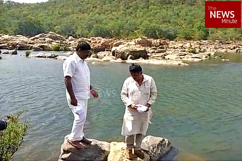
On Friday, Karnataka Water Resource Minister DK Shivakumar the visited site where the proposed Mekedatu dam would be constructed. DK Shivakumar’s visit comes after the Central government granted approval for the preparation of the detailed report on the project.
Ahead of his visit, engineers from the Water Resource Department had already visited Mekedatu and began the demarcation of land required for the construction of the dam. However, officials with the department say that the proposed plan will not only submerge surrounding villages and a few prominent temples but is also a threat to the elephant corridor.
Where will the project come up?
According to officials with the Water Resource Department, the project will require acquisition of the land from the Mugguru Forest’s watch tower up to the outer regions of the foothills near Hanur Forest near Kollegal in Mysuru district. Mugguru Forest is located in the border between Karnataka and Tamil Nadu and is 9.1 km away from Mekedatu.
The area where the proposed dam will come up is located between Mekedatu and a popular tourist destination - Sangama, where the Cauvery and Arkavathy rivers meet.
“The actual dam will be in between Mekedatu and Sangama. A hydro-power generation will also be constructed just 2 km away from the dam and we have surveyed the land as well. There are a few cement houses near the dam, which will have to be acquired as it will be submerged once the dam is built. We have also demarcated the land on a few hills in the area, which are likely to be submerged,” an official with the Water Resource Department said.
Officials say that the 67 TMC capacity reservoir will submerge Sangama, a tourist spot in Karnataka, which attracts over 2,000 people every day. “We require 4,716 hectares of land for the project. 90% of the land is forest land and only 10% is revenue land,” the official added.
Sources say that the elephant corridor in the forest area in Sangama will also be disturbed once the project is constructed. “We are yet to take stock of the number of trees that will have to be cut down. It will certainly be over 10,000. In 2017, we had formulated one detailed project planning. However, we are in the process of preparing a fresh planning,” the official added.
Six villages - Bommasandra, Galebore, Madivala, Kogge Doddi, Nelluru Doddi and Sampatagere Dodd - will be submerged if the project becomes a reality. “The land will be demarcated and included in the detailed project planning. Only after it is approved, we can begin the land acquisition process,” the official added.
Currently, the city receives 1,350 million litres per day (MLD) of Cauvery Water and the project aims to be able to meet the drinking water requirements by 2030. Officials say that Bengaluru will need 2,285 MLD of water by 2030, which can be met if the Mekedatu project is successfully constructed.
