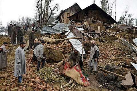
Over 12 per cent of the country's total land area, which amounts to around 0.42 million square kilometres, is vulnerable to landslide hazard, the Geological Survey of India has said.
About 12.6 per cent of the total land mass of India falls under the landslide-prone hazardous zone, according to a study by the GSI, under the directive of the Ministry of Mines.
"Out of the total land area prone to landslide, 0.18 million square kilometres fall in the North East Himalayas, including Darjeeling and Sikkim Himalaya. About 0.14 million square kilometres fall in North West Himalayas in states like Uttarakhand, Himachal Pradesh and Jammu and Kashmir," the study said.
"Another 0.09 million square kilometres in Western Ghats and Konkan hills in states like Tamil Nadu, Kerala, Karnataka, Goa and Maharashtra and 0.01 million square kilometre in Eastern Ghats of Aruku area in Andhra Pradesh are found to be landslide-prone," it said.
As per the Ministry of Mines' directive in 2013, the GSI envisaged a six-year-long national programme, the National Landslide Susceptibility Mapping (NLSM), in each of its regions from field season (FS) 2014-15 to prepare seamless 1:50,000 scale landslide susceptibility maps following a GIS-based approach.
According to a senior GSI scientist, the GSI-based approach was done through development and use of site-specific/terrain-specific weights/ratings, adequate field and remote sensing inputs.
"The landslide-prone Himalayan terrain also belongs to the maximum earthquake-prone zones where earthquakes of Modified Mercalli intensity VIII to IX can occur, and thus, are also prone to earthquake-triggered landslides," the geologist at the GSI headquarter in Kolkata told PTI.
The GSI has the onus as the "nodal agency" for the Indian government for landslide data repository and landslide studies and it is engaged in all types of landslide and slope stability investigations. In fact, GSI has been carrying out macro scale (1:50,000) landslide susceptibility zonation since last four decades.
However, compared to the available landslide-prone areas in India (0.42 square kilometre), the target achieved so far by GSI (60,000 square kilometres) till FS 2013-14 has been only 14 per cent.
Moreover, the existing landslide susceptibility maps are old and analogue maps which are difficult to be disseminated and updated in future. This warranted GSI to impart maximum stress on completion of this basic task on landslide susceptibility at a faster pace.